The next hike in this location is on 23rd of August.
If you’re ready for a full-day adventure on foot — one that takes you across volcanic ridges, through humid forests, and past steaming fumaroles — this trail is for you.
Starting in Agualva and ending in Biscoitos, this long but rewarding route connects several of Terceira’s most iconic (and lesser-known) natural spots. It’s not an official trail, but with some planning and a sense of direction, it becomes an unforgettable journey.
🚩 Starting Point: Agualva
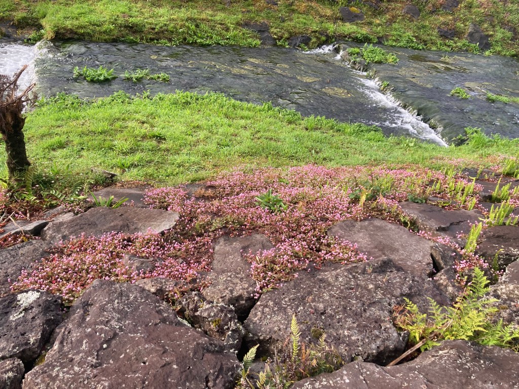
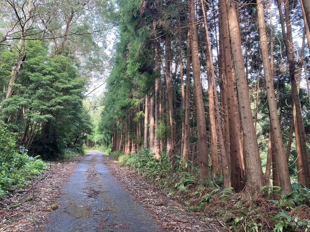
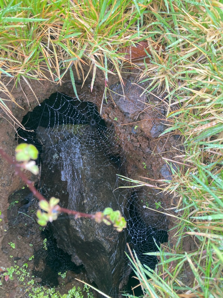
Begin your hike in the parish of Agualva, one of the oldest settlements on the island. Right outside the village lies Parque das Frechas, a small but peaceful park filled with native laurel forest, streams, and lava formations. It’s a perfect warm-up spot before the climb begins.


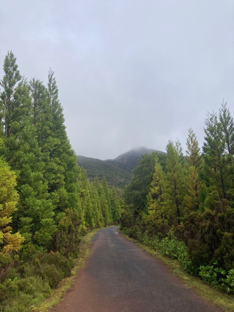
🏔️ The Climb to Miradouro do Pico Alto
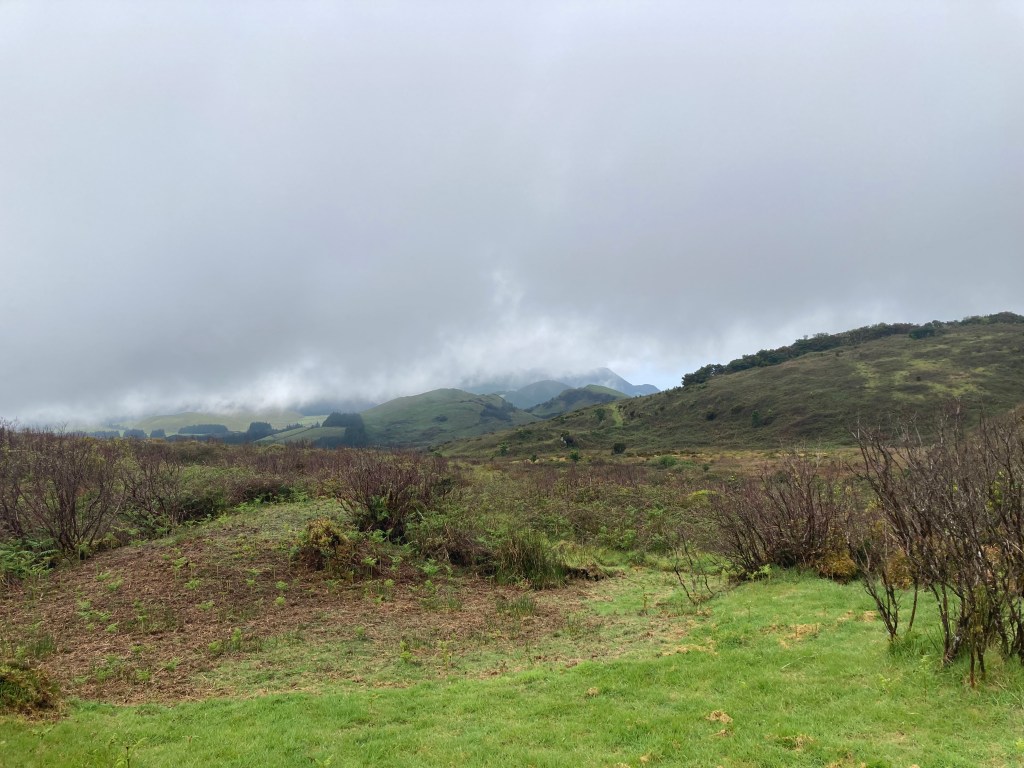
Next, head toward Miradouro fo Pico Alto. This extinct volcano offers panoramic views in all directions: ocean, forests, crater rims, and pastures. On clear days, you can even spot nearby islands.
The area around Pico Alto is part of a dense, humid forest that feels almost tropical. Moss carpets the rocks, ferns grow thick, and the trail feels alive with birdsong.


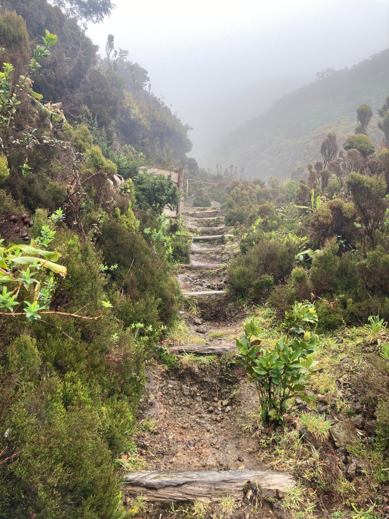
🌋 From Mist to Steam: Furnas do Enxofre
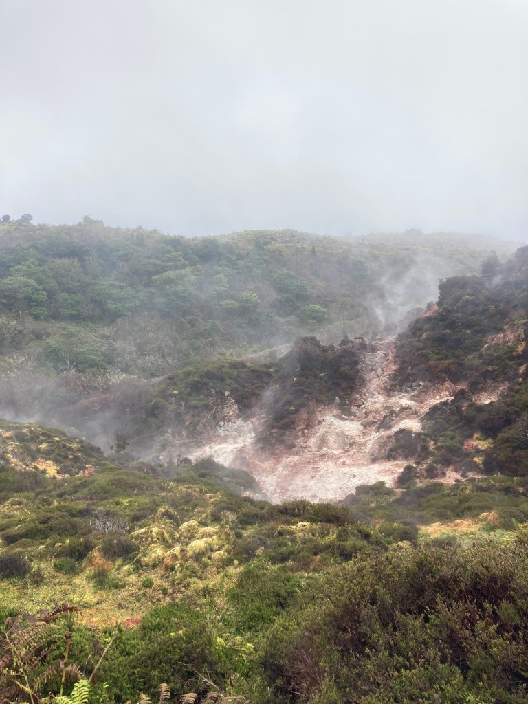
After descending from Pico Alto, make your way to Furnas do Enxofre — a geothermal area with active fumaroles, steaming vents, and the smell of sulfur in the air. It’s one of the few spots on Terceira where you can literally see the island breathing.
Take your time on the wooden walkway, soak in the strangeness of this otherworldly spot, and be mindful of where you step — the ground here is still alive.

🍇 Descent to the Ocean: Ending in Biscoitos
The final stretch takes you down near the road and past agricultural land until you reach Biscoitos, a coastal town famous for its natural lava swimming pools and verdelho wine.
By the time you reach the sea, you’ll have crossed a huge portion of Terceira on foot — from inland ridges to oceanfront basalt. Grab a swim, a cold drink, or just a moment to reflect on the landscapes you’ve walked through.


⏱ Trail Details
- Total distance: ~24–26 km (depending on your exact route)
- Estimated time: 6–8 hours (allow time for breaks, photos, and slowdowns)
- Difficulty: Moderate to challenging (mostly due to distance)
- What to bring:
- Plenty of water and snacks
- Good hiking shoes
- Offline map or GPS — parts of the route are unmarked
- Layers — the weather can shift quickly, especially around Pico Alto
Getting There & Public Transport Info
- The trail can be completed entirely on foot, making it accessible for those without a car.
- Buses from Praia da Vitória to Biscoitos operate from 8:00 to 19:00 on weekdays and from 8:00 to 17:00 on Saturdays. Be sure to plan
🌿 Final Thoughts
This hike isn’t short, but it captures Terceira’s essence: forest, fire, fog, and sea. If you want to experience the island beyond viewpoints and paved trails, the route from Agualva to Biscoitos delivers the full picture — one step at a time.

Leave a comment